People before Highways
“In 1906, an elevated railway extended from Dudley Square to Forest Hills, running along Washington Street through Egleston Square. The construction of this elevated train represented the greatest change for the district. Though the area was well served by quick transportation into Boston with two stations (Egleston Square and Green Street), the existence of the elevated rail created a dark and dirty streetscape. Businesses suffered and a sense of discomfort and danger persisted under the tracks. Centre Street began to attract more businesses, and the surrounding residential area retained its middle class base, while the Washington Street corridor became more and more degraded and deteriorated over the decades of the 20th century.
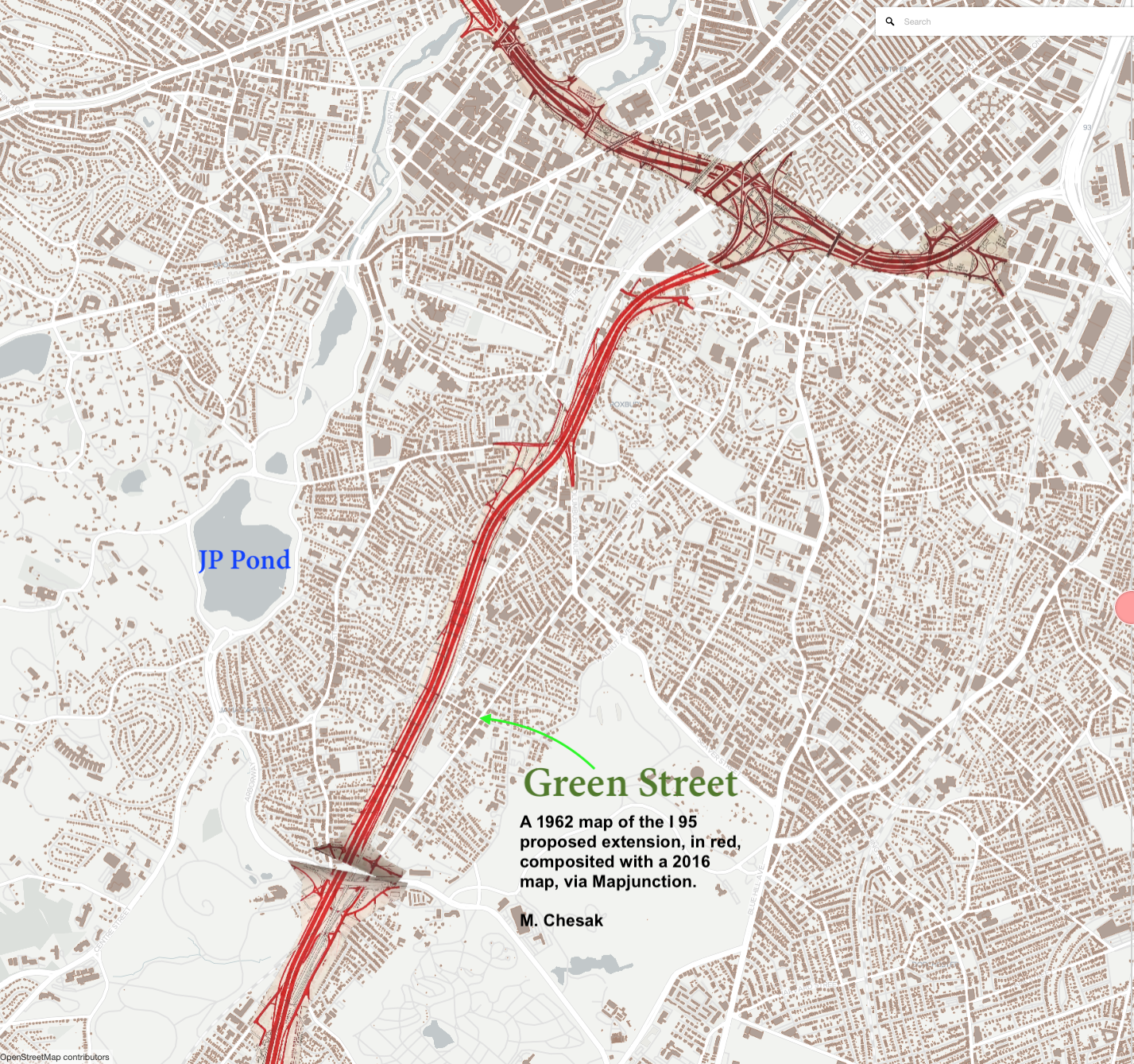
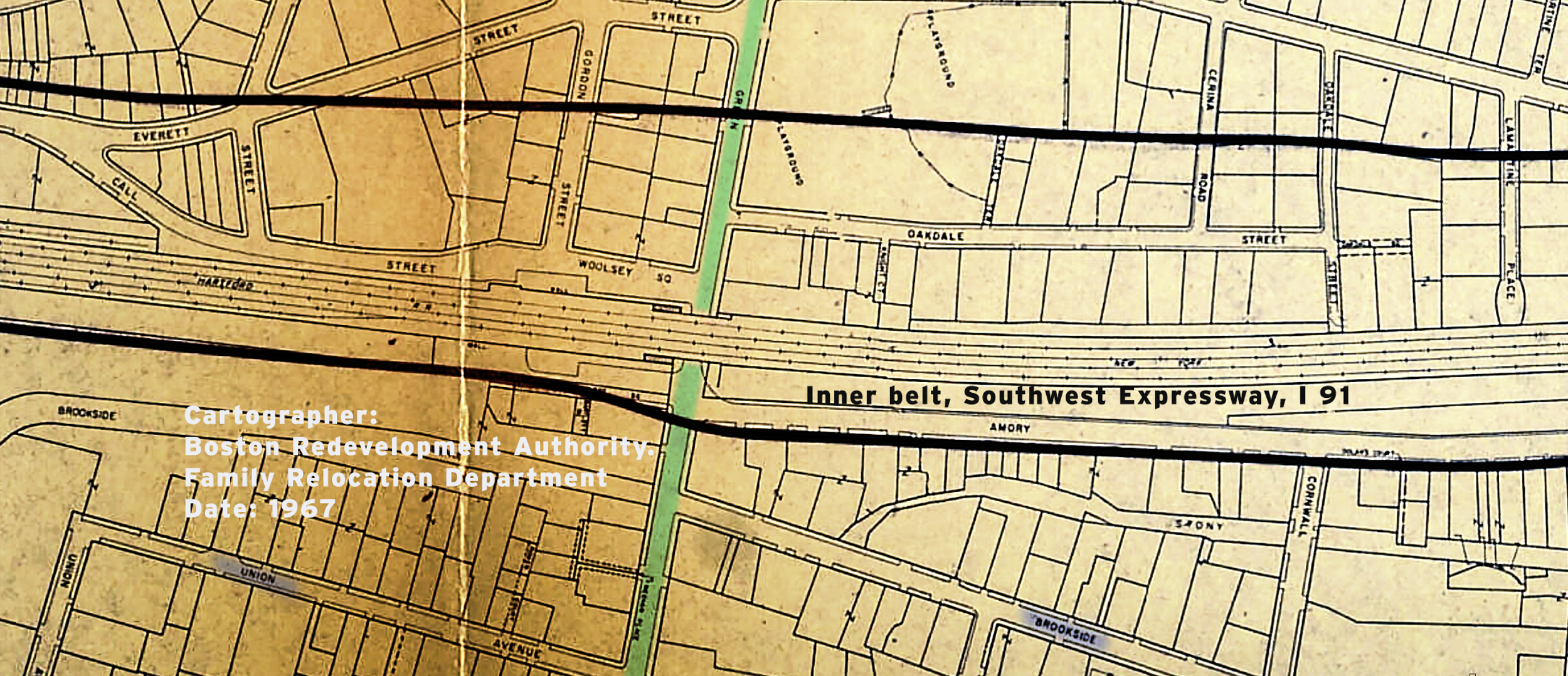
The … area suffered, as did all urban neighborhoods, during the middle of the 20th century from influence of the automobile and the exodus of the middle class to the surrounding suburbs... highways themselves began to threaten the vitality of this neighborhood, as plans to build an expressway through Jamaica Plain, Roxbury and the South End began to surface as early as 1948. By 1966 the Commonwealth revealed plans for an eight-lane “Southwest Expressway”, or the “Inner Belt” that would connect I-95 to I-93, the “Southeast Expressway” and soon began to relocate families and businesses along the proposed project area. The results were devastating to the area and residents, mostly minorities and immigrants who lacked political power and support, felt helpless to stop the highway from ripping their neighborhoods apart. Stores and homes stood abandoned, attracting vandalism and crime.
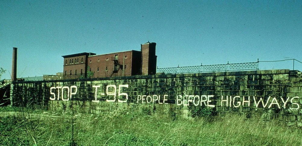
What happened next is one of the best examples of citizen activism in Boston history. Angered and dissatisfied by the Central Artery project in downtown Boston that created horrific traffic jams and drastically split apart urban neighborhoods, residents organized and began to fight the Inner Belt and Southwest Corridor highway project. After years of protest and a considerable loss of the built environment, Boston residents’ voices were finally heard and in 1972, Governor Francis Sargent halted the highway plans. In the years that followed, new plans were created to use the already cleared land for the six- mile linear Southwest Corridor park system and the relocated MBTA Orange Line. The communities in Hyde Park, Jamaica Plain, Roxbury and the South End had successfully fought off the highway project that surely would have cost these neighborhoods their vitality and damage to their future. The relocation of the Orange Line also led to another drastic change for the Egleston Square neighborhood: the removal of the elevated railway that had darkened Washington Street for nearly a century in 1986. While the area lost its direct access to rapid transit (which is still a short distance away at Stony Brook station), it also benefited from the newfound openness and light. Today, there are still signs of the existence of the elevated railway, including long neglected storefronts that were once in the shadow of the tall steel beams and rails.”
Source: Historic Boston Incorporated, Commercial Casebook: Egleston Square, 2009-2011